
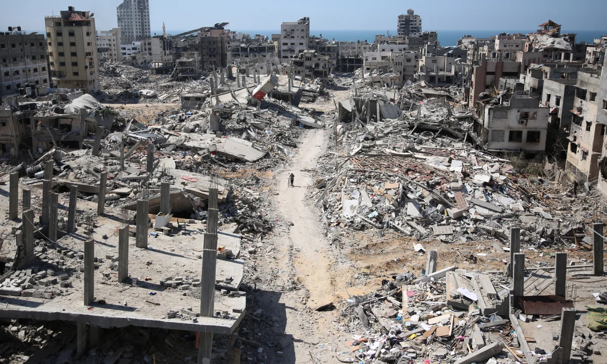
Recent satellite images have laid bare the scale of devastation across Gaza City, showing entire neighbourhoods reduced to rubble as Israeli forces intensify military operations. From March through early September 2025, numerous districts once filled with homes, markets, schools, and community centres now stand in ruin.
What the Pictures Show
- The neighbourhood of Zeitoun has been almost entirely levelled. Thousands of homes have been destroyed, leaving streets unrecognizable and residents displaced.
- In Remal, many high-rise residential and commercial towers have been razed. Once prominent buildings like Mushtaha Tower, Al-Ruya, Al-Salam Tower, and Tiba Tower are among those destroyed.
- Beit Hanoon and Beit Lahiya in northern Gaza have also suffered heavy damage. Fields, orchards, and housing in Beit Lahiya have been bulldozed, leaving large swathes of land barren.
- Sheikh Radwan, Sabra, and Tuffah have seen repeated military strikes. Markets, residential blocks, and tent encampments have been hit, some structures destroyed entirely, others severely scarred.
- Jabalia refugee camp, one of the most densely populated areas, has suffered new strikes. Buildings once sheltering families are now partially or fully damaged; infrastructure has been severely compromised.
Humanitarian Fallout
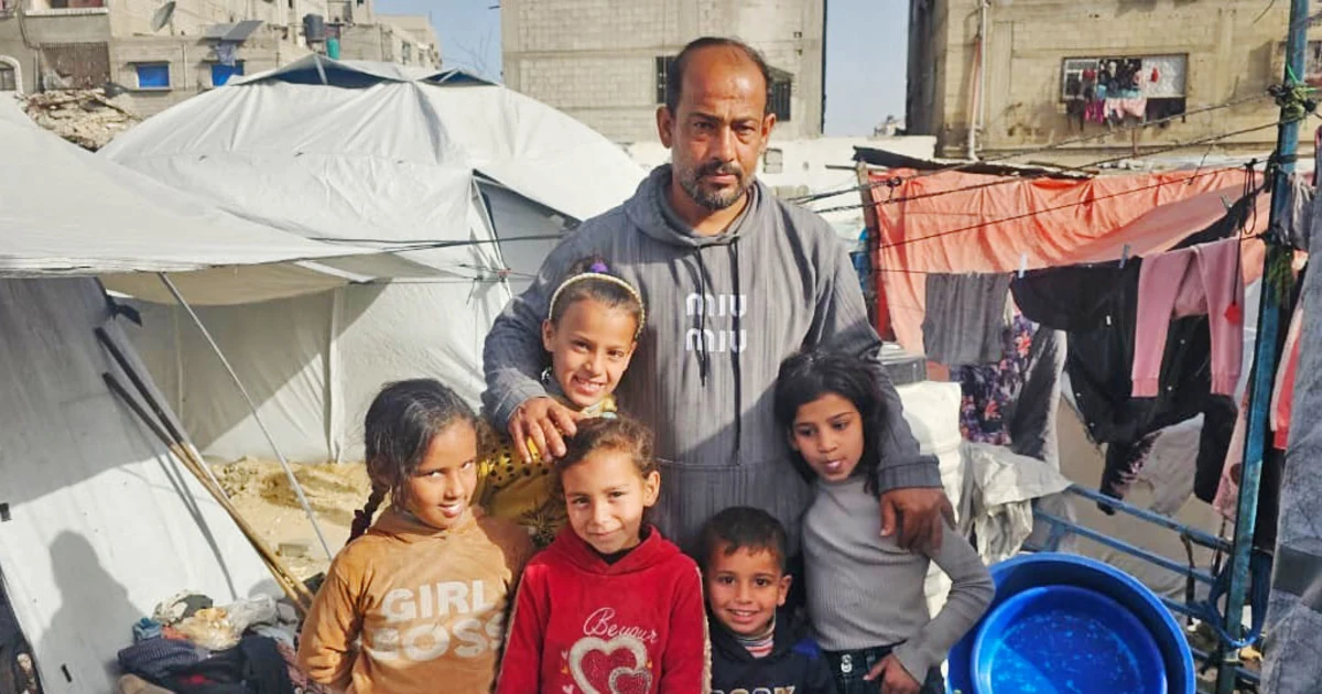
- Tens of thousands of people have been forced to flee their homes in Gaza City and northern Gaza. Many are heading south or to central parts of the Gaza Strip, though some return due to lack of shelter elsewhere.
- Evacuation routes are limited. Key roads like Salah al-Din Street are under sniper threat, and coastal al-Rashid Street—crowded with the displaced—has become dangerous.
- Institutions critical for daily life—hospitals, schools, places of worship, UN-run facilities—show damage in the satellite imagery. Some have been destroyed or disabled outright.
- The “humanitarian zone” designated in the southern coastal area, al-Mawasi, has failed to provide a safe haven; the images suggest even this zone is under threat and remains unsafe for many.
Broader Implications
- The destruction has erased much of the fabric of daily life: homes, social spaces, public services, livelihood-related infrastructure have been heavily affected.
- The damage to infrastructure not only displaces people but also disrupts access to basic services—healthcare, water, education—compounding an already severe humanitarian crisis.
- The rebuilding challenge will be massive. Flattened neighbourhoods and destroyed towers imply years of work to restore housing. Displacement, lack of safe routes, and damaged infrastructure make returning and rebuilding difficult.
- The images make visible what many aid groups and local authorities have warned: that large parts of Gaza City are no longer just damaged; parts are uninhabitable.
Voices from the Ground
Residents and civil defence officials report that dozens of multistorey buildings have been obliterated in recent weeks alone. They speak of a sense of loss—not just of houses, but of landmarks, community centres, schools, places where people gathered, prayed, lived. Neighbourhoods once known for their markets, narrow alleys, gardens, are now piles of concrete, twisted metal, ash.
In Summary:
The satellite imagery from Gaza City reveals a humanitarian catastrophe unfolding in full view. Beyond the loss of buildings, there is deep damage to lives, communities, and the chances of a quick return to normalcy. The scale of destruction calls not only for urgent aid but also for a long-term strategy for recovery, protection of civilians, and restoration of infrastructure.


Leave a Reply