
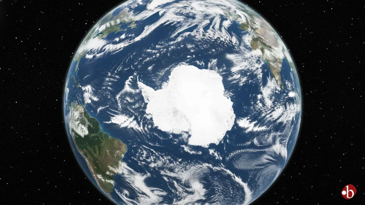
Scientists have unveiled the most detailed map yet of the terrain buried beneath Antarctica’s massive ice sheet, revealing a previously unseen world of mountains, valleys, ridges, and other geological features. This breakthrough provides crucial insight into how the ice flows and how the continent may respond to future climate change.
For decades, the continent’s thick ice — reaching up to 3 miles (4.8 km) in some regions — has concealed its underlying landscape. Traditional surveys using aircraft and ground-based radar offered only partial views, leaving much of Antarctica’s subglacial terrain a mystery.
Discovering an Ancient Landscape
By combining high-resolution satellite data with computer models that simulate glacier movement, researchers created a continent-wide map of the hidden bedrock. The results are striking: tens of thousands of previously unknown hills and ridges, deep valleys, and ancient formations are now visible.
Understanding the shape of the land beneath the ice is critical. The underlying topography influences how glaciers move, how meltwater travels, and how the ice sheet could behave as global temperatures rise. This knowledge will help scientists improve predictions of ice loss and global sea-level rise.
How the Map Was Made
Instead of relying solely on radar, scientists used satellite measurements of the ice surface to infer the contours beneath. The ice subtly reflects the shape of the bedrock below, allowing researchers to model hidden valleys, ridges, and slopes. This method fills gaps left by previous surveys and provides a comprehensive view of Antarctica’s underground landscape.
Key findings from the map include:
- Sharp topographic transitions marking ancient geological boundaries.
- Deep channels that may have influenced historical ice flow.
- Patterns resembling glaciated mountain terrain seen in ice-free regions.
- Surface roughness that affects how ice moves and melts.
Implications for Climate Science
Mapping Antarctica’s hidden terrain is more than a curiosity; it is essential for accurate modeling of ice sheet behavior. Variations in bedrock shape can accelerate or slow ice loss depending on how glaciers interact with the terrain. Better understanding of these features enables climate scientists to refine predictions for sea-level rise, an urgent concern for coastal communities worldwide.
A Hidden World Comes Into Focus
The new satellite-based mapping has illuminated a diverse, ancient landscape that has remained hidden for millions of years. These insights not only deepen understanding of Antarctica’s geological history but also enhance scientists’ ability to anticipate future changes in the ice sheet and the global climate.


Leave a Reply