
The Caribbean is once again facing the fury of nature as Tropical Storm Melissa continues to strengthen in the warm waters of the Caribbean Sea. Meteorologists warn that the system could intensify into a major hurricane within days, bringing life-threatening flooding, landslides, and damaging winds to Jamaica, southern Haiti, and possibly parts of eastern Cuba and the Bahamas.
A Brewing Monster in the Caribbean Sea
As of Saturday, Melissa was hovering south of Jamaica, moving at an agonizingly slow pace — a factor that forecasters say could make it particularly destructive. The storm’s forward motion has remained under 5 mph, giving it ample time to draw energy from the Caribbean’s exceptionally warm waters, which are nearly 2°C above average for this time of year.
Meteorologists from regional weather centers have expressed growing concern over Melissa’s slow track. The sluggish pace means that rainfall will accumulate over the same areas for an extended period, significantly increasing the risk of catastrophic flooding and landslides.
The storm’s current wind speeds are nearing hurricane force, and with favorable atmospheric conditions — including low wind shear and high ocean heat content — the system is expected to strengthen rapidly. Some forecast models project Melissa to reach Category 4 or even Category 5 intensity before it nears Jamaica’s southern coastline early next week.
Jamaica on High Alert
Jamaica’s Prime Minister has placed the island under a state of emergency preparedness, urging residents in low-lying and coastal areas to move inland or to higher ground. Shelters have been activated across the island, particularly in Kingston, St. Elizabeth, Clarendon, and St. Thomas — regions expected to take the brunt of the storm.
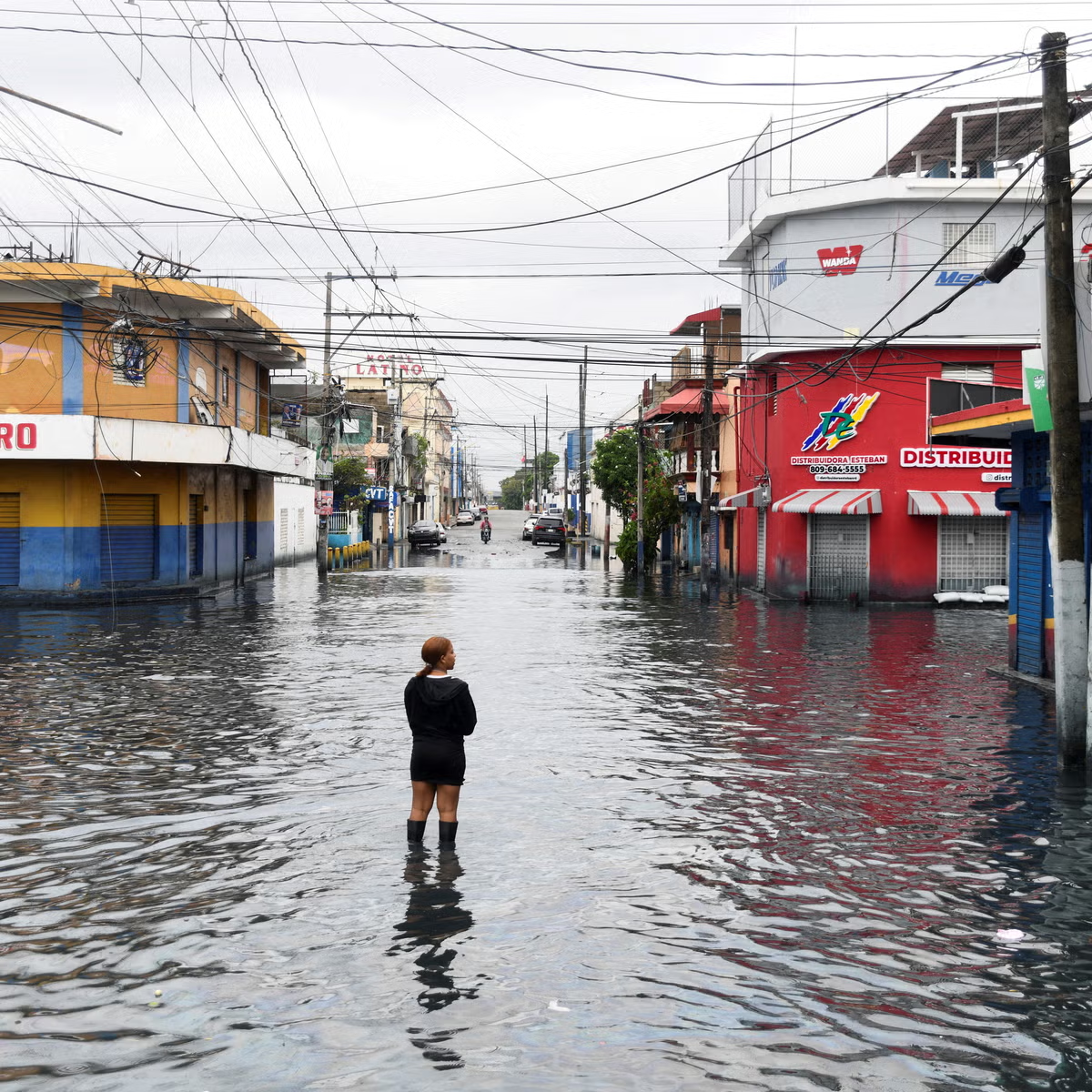
The Meteorological Service of Jamaica has issued hurricane warnings for the entire island. Authorities warn of potential storm surges between 5 and 10 feet along the southern coast, with inland flooding expected to be severe due to the storm’s slow movement.
“Melissa’s biggest danger isn’t just the wind,” said Dr. Janelle Forbes, a meteorologist at the Caribbean Weather Center. “It’s the sheer volume of rain. We could be talking about 20 to 40 inches in some areas — enough to cause flash floods, mudslides, and widespread damage.”
The government has pre-positioned emergency supplies, while hospitals and emergency services have been placed on high alert. However, officials acknowledge that the country’s infrastructure — particularly its power grid and road networks — could face “significant disruption” if Melissa maintains its projected strength.
Haiti Faces a Double Tragedy
For Haiti, Melissa’s approach poses an even greater humanitarian concern. The storm’s outer bands have already reached the country’s southern peninsula, triggering flash floods and small landslides. Reports from local officials indicate that several homes have been washed away, and at least a few casualties have already been confirmed in early flood incidents.
Southern Haiti, still recovering from years of natural disasters — including the 2021 earthquake and multiple hurricanes — is ill-equipped to handle another major storm. Many regions lack stable housing and proper drainage systems. The nation’s civil protection agency has warned that if Melissa lingers near the coast, hundreds of thousands could be displaced by flooding and landslides.
Humanitarian organizations are scrambling to prepare, but widespread gang violence and road blockades are complicating logistics. Aid groups warn that post-storm recovery could be hindered by limited access to affected areas.
The Science Behind the Storm’s Strength
Meteorologists note that Melissa has benefited from a perfect blend of conditions for rapid intensification. The Caribbean Sea’s unusually warm waters, combined with light upper-level winds, have allowed the storm’s core to organize efficiently. Satellite imagery shows the formation of a developing eye feature, a telltale sign of strengthening.
In addition, climate scientists emphasize that warming oceans are making tropical systems more powerful and longer-lasting. A storm that might have dissipated decades ago now has the energy to evolve into a monster system.
Dr. Forbes adds, “We’re seeing a pattern where slow-moving tropical storms like Melissa cause more rainfall-related deaths than the wind itself. The combination of stalling motion and record ocean temperatures is particularly dangerous.”
Regional Impacts Beyond Jamaica and Haiti
While Jamaica and Haiti are the immediate targets, the broader Caribbean could also feel Melissa’s wrath. Forecast models indicate that the storm may pass near eastern Cuba, the Cayman Islands, and later threaten the Bahamas. Even areas far from the storm’s center could experience torrential rain, dangerous surf, and coastal flooding.
By midweek, forecasters expect Melissa to curve northward, potentially brushing parts of the Turks and Caicos Islands before heading into open waters. However, long-range models remain uncertain, with some indicating that remnants of the storm could influence weather patterns along the U.S. East Coast by next weekend.
Preparation and Evacuation Efforts Intensify
Authorities across the region are urging swift action. Jamaica’s emergency management agency has mobilized rescue teams, and schools have been converted into shelters. Airlines have canceled dozens of flights, and ports have suspended operations.
In Haiti, the situation is more precarious. Many residents lack access to vehicles or secure shelters. The government has called on international aid partners for assistance, fearing a repeat of past tragedies where slow-moving storms resulted in large-scale casualties.
Residents are being advised to stock up on essentials, secure property, and stay tuned for emergency alerts. Power outages are expected to be widespread, and telecommunications may be disrupted for days.
A Growing Pattern of Extreme Weather
Melissa’s development underscores an alarming trend in recent years: tropical storms that intensify rapidly and linger longer than before. The phenomenon has been observed in several major storms, including Hurricanes Dorian and Harvey, both of which caused catastrophic flooding.
Experts attribute these patterns to a warming climate that is fueling stronger, wetter, and slower tropical systems. The result is a higher risk of long-duration rainfall and storm surge events that devastate coastal and inland communities alike.
A Region Bracing for Impact
As the Caribbean braces for Melissa’s approach, a sense of grim familiarity hangs over the region. Residents who have lived through previous storms know the sound of the wind and the surge of rising water all too well. Still, officials hope that early warnings and widespread preparation will save lives.
Whether Melissa makes landfall as a high-end Category 3 or a Category 5 hurricane, experts agree on one thing: the storm’s slow and punishing assault could be one of the most dangerous events of the 2025 hurricane season.


Leave a Reply